 Warner Robins
  Wantagh
  Bethel
  Misty Hill Farm
  United States
  Wakonda Beach (R33) Airport
  Wilmington
  Poland
  Miami International Airport
Cherokee Ranch & Castle on the map, Highlands Ranch, United States
Photo

Where is located Cherokee Ranch & Castle
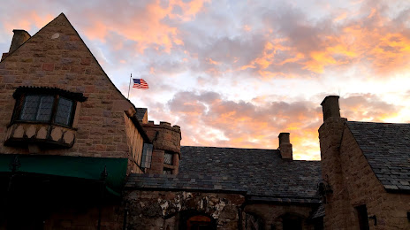
Cherokee Ranch & Castle — local attraction, which is located at 6113 N Daniels Park Rd, Sedalia, CO 80135, United States and belongs to the category — ranch. Average visitor rating for this place — 4.7 (according to 315 ratings, information from open sources and relevant for 2022).
Exact location — Cherokee Ranch & Castle, marked on the map with a red marker.
You can get directions to Cherokee Ranch & Castle on the map from your location.
What else is interesting in Highlands Ranch? You can see all the sights if you go to the city page.
Coordinates
Cherokee Ranch & Castle, United States coordinates in decimal format: latitude — 39.44614798635104, longitude — -104.92698776770183. When converted to degrees, minutes, seconds Cherokee Ranch & Castle has the following coordinates: 39°26′46.13 north latitude and -104°55′37.16 east longitude.
Nearby cities
The largest cities that are located nearby:
- Lakewood — 20 km
- Denver — 21 km
- Aurora — 23 km
- Arvada — 30 km
- Westminster — 32 km
- Thornton — 35 km
- Colorado Springs — 80 km
- Fort Collins — 115 km
- Pueblo — 146 km
- Albuquerque — 515 km
- Valencia — 548 km
- Amarillo — 556 km
- Provo — 569 km
- Salt Lake City — 595 km
- West Jordan — 596 km
- West Valley City — 603 km
- Wichita — 699 km
- Lincoln — 708 km
- Lubbock — 720 km
Distance to the capital
Distance to the capital (Washington) is about — 2396 km.
